|
Background
I worked for several
years as a visiting scientist at the Manne
Siegbahn Institute in Sweden. During my final year
there, my group leader, Prof.
Thomas Lindblad decided to work on a nano-satellite
project.
He asked me to
help him develop a basic satellite ground station to
gain some experience with satellite communications and
also as a possible source of educational projects
suitable for undergraduate and high school students.
Here I present
an introduction to weather satellite reception and review
a sequence of 5 systems that we put together
going from a cheap, basic system,
using freeware and PC sound cards, to a more
expensive, elaborate system with commercial software
and components. (Even the cost of the later, however,
is well within the range of many home entertainment
centers.)
Note:
We got lots of assistance from space radio experts Bruce
Lockhart and Henry
Bervenmark. Also, Sven
Grahn, of the Swedish
Space Corporation and a long-time space radio enthusiast,
gave us some useful tips.
LEO
vs GEO
Weather
satellites can generally be categorized as Low Earth
Orbiters (LEO) and Geostationary Orbiters (GEO). The
LEO satellites typically follow an orbit of a few hundred
to a couple of thousand kiliometers in altitude.
The GEO satellites
orbit at around 40,000km above the equator where they
move at the same angular speed as the rotation of the
earth and so appear to be suspended above a given point
on the equator.
The GEO satellites
get a view of most of a hemisphere of the earth and
can monitor the weather of that region over time.
The LEO satellites,
on the other hand, constantly move relative to the earth's
surface so cannot monitor a given area continously.
But they are closer and so can obtain sharper pictures
than the GEO satellites.
The LEO weather
satellites also orbit from pole to pole. This allows
them to pass over most areas on earth at least once
within a given time.
NOAA
Polar Orbiters
The US National
Oceanographic and Atmospheric Administration (NOAA)
operates both GEO
and LEO polar satellites. Here we concentrate primarily
on the polar orbiters.
The NOAA polar
satellites orbit at 850km and pass within view of all
areas on earth at least twice day. The satellite carries
a number of instruments including cameras for both visible
and Infrared light.
The cameras scan
back and forth at right angles to the ground path, like
a broom sweeping side-to-side as you walk forward, taking
picture strips that cover an area 3000km wide. The satellite
thus makes a continuous picture as if it was a tape
reeling out from an endless roll.
The image, however,
is not recorded on the satellite. Each image strip is
immediately broadcast to the ground at a frequency just
above 137MHz. The satellite will be in range
for up to 12min as the satellite passes from horizon
to horizon.
The broadcast uses
the APT
(Automatic Picture Transmission) analog format for the
imagery. (A digital format - High Resolution Picture
Transmission (HRPT ) signal is also transmitted but
it is more difficult to receive and decode and we did
not try to receive it in this project. )
Currently, there
are 6 operational NOAA polar orbiters but usually only
two or three have the APT activated at a given time.
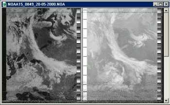
(In this report, only images from NOAA-14 and NOAA-15
were received.) See NOAA satellite Status.
The Russian METEOR
series of satellites also broadcast with the APT
format. In addition, the remote sensing SICH and OKEAN
radar satellites occasionally broadcast images but only
over Russia (scanners in nearby countries have picked
up some of these images.)
Procedure
for APT Reception
To obtain the LEO
weather sat images, the following basic steps are required:
- Track
the desired satellite to find when it will appear
and how long it will be in view (i.e. how high in
elevation it will rise). (See NASA's
online
J-Track program for an example of NOAA satellite
tracking.)
- Tune
the receiver to the right frequency, e.g. 137.620MHz
for NOAA-14 and 137.500 for NOAA-15 and pick off the
AM signal that carries the image data. The 2400Hz
AM subcarrier signal will produce a distinctive
"tick-tock" sound from the speakers.
- Receive
the signal for as much of the satellite pass as possible.
- Decode
the signal into the image (Depending on the system,
this is done in real-time or the signal is saved to
file that is decoded later.)
Find more links
to introductory
info about weather satellite reception
see the main Space
Radio page.
Note:
There are many other options to the particular
hardware and software components that we chose for our
systems. Explore the weathersat
links to find the system that is best
for you.
|


